Project
Great East Japan Earthquake Disaster
Geographic Distributions of Cultural Heritages Which Suffered Damage from the Great East Japan Earthquake (updated: 8 April 2012)
The Institute of Disaster Mitigation for Urban Cultural Heritage at Ritsumeikan University has the aim to establish theories and methodologies to conserve historical cities with cultural heritages for future generations. Given the great disaster caused by the earthquake occurred in the eastern part of Japan on the last March, we decided to assemble and disseminate the information on damaged cultural heritages to the public as one of our important task to fulfill the aim of our institute.
Although such damaged heritages are widely distributed over Japan, we release maps of registered national cultural heritages and their damages in the Tohoku area. These maps were designed in a GIS environment. We should note that the current information of cultural heritage damages is limited and needs further examination.
Maps of damaged cultural heritage distributions (select region)
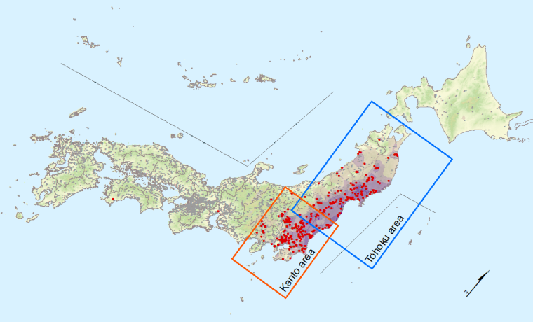
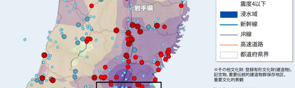
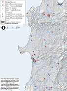
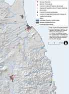
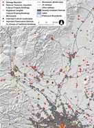
Maps of damaged cultural heritage distributions in Tohoku area
We herewith release maps of the distribution of registered national cultural heritages which suffered from the Great East Japan Earthquake.
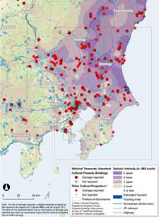
- A. Overview of the distribution of the damaged cultural heritages with seismic activity surface in entire Tohoku area. The righthand map is an index map showing geographic extents of enlarged maps.
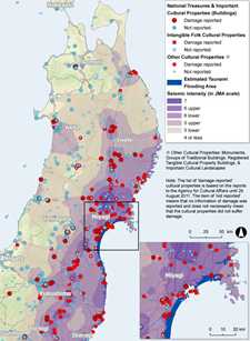
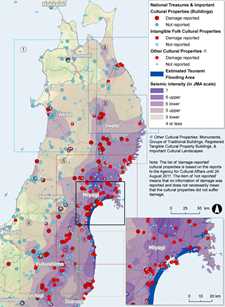
- B. Detailed distributions of the damaged cultural heritages with Tsunami flooding areas estimated by PASCO Inc. in selected parts of Tohoku area (enlarged maps)
 |
 |
 |
| (1) Western Aomori and Akita | (2) Eastern Aomori and Northern Iwate | (3) Southern Iwate |
| (4) Coast-side Fukushima | (5) Miyagi and Northern Fukushima | (6) Inland Fukushima |
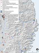
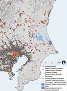
Maps of damaged cultural heritage distributions in Kanto area
- A. Overview of the distribution of the damaged cultural heritages with seismic activity surface in entire Kanto area. The righthand map is an index map showing geographic extents of enlarged maps.
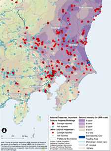
- B. Detailed distributions of the damaged cultural heritages with Tsunami flooding areas estimated by PASCO Inc. in selected parts of Kanto area (enlarged maps)
 |
 |
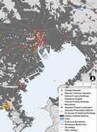 |
| (1) Gunma and Tochigi | (2) Ibaragi and Chiba | (3) the Coast of Tokyo Bay |
Notes
The list of ‘damage-reported’ cultural properties in these maps is based on the reports to the Agency for Cultural Affiars until 26 August, 2011. The item of ‘not reported’ means that no information of damage was reported and does not necessarily mean that the cultural properties did not suffer damage. Also it should be noted that there are wide variety of damage to cultural heritages and the severity of such damage is not classified.
The source information for GIS mapping
- Cultural heritages / cultural properties
The database of registered national cultural properties of the Agency for Cultural Affiars.
The information on the cultural heritages which suffered from the Great East Japan Earthquake (the Agency for Cultural Affiars: unpublished) - Physiography, Hydrology and Densely inhabited areas
ArcGIS Data Collection Standard Pack (ESRI Japan Inc.)
Digital maps of the Geospatial Information Authority of Japan (GSI)
Digital Elevation Model (10 m resolution) - Seismic activity
The information on seismic activity in JMA scale of the M9 earthquake which occurred at11th March in 2011 was obtained from the Emergency Mapping Team. Kriging-based interpolation was used for overlaying with the distribution of damaged cultural properties. - Estimated Tsunami flooding area
PASCO Inc. made this GIS-based information by referencing aerial photos and satellite images. It should be noted that the distribution of flooding area may contain estimation errors which should be carefully evaluated by field-based surveys in the future. The detailed geographic distribution of the estimated flooding areas and other GIS-based works on the disaster by PASCO Inc. are available at the following website. Information on “The Great East Japan Earthquake 2011“.