The risk identification process
The objectives of this module are to introduce the basic methodology for undertaking risk assessment of cultural heritage sites and enable participants to prioritise risk reduction strategies and decide on the approach for mitigation. The first stage within this process is the identification and analysis of potential risks.
Read More...
The role of risk assessment for disaster risk management should be emphasised for participants in this lecture. It is possible to combine all the sections of this module in a single introductory lecture, and then elaborate each step using thematic lectures. Assessing values of heritage sites and property should be illustrated through examples and references from international charters and approaches, introduced in the previous module. Detailed lectures may help in exploring specific techniques of risk assessment and behavior of structures in case of a disaster resulting from specific hazards such as earthquakes, cyclones etc.
Individual steps in risk analysis depend greatly on the scale and nature of the site and the types of hazards being addressed, so at this stage in the course, thematic focus becomes fairly significant. Thematic lecture presentations could potentially be linked with secondary case studies building upon the application of analysis methods to actual heritage buildings or sites.
Participants working on a primary case study through the length of the course or though the length of this module could use this opportunity to begin the process of risk assessment on their own with the assistance of the instructor. This could be in the form of independent study groups or discussions or be linked with a workshop combining the content of the various sections of this module.
In case participants are working on individual or team projects of their own selection, they may be given initial assignments based on the material they have gathered prior to the course. Formats and worksheets may be given to participants to initiate this process.
Performance of Historic Masonry Structures, Lecture 6, International Training Course, 2012
Instructor: Aiko Furukawa
Duration: 60 minutes
Read More...
Seismic Performance of Japanese Historical Structures, Lecture 6, International Training Course 2011
Instructor: Kazuyuki Izuno
Duration: 60 minutes
Read More...
| S.NO | Observations at the Site and its immediate surroundings (Damage or Deterioration pattern / phenomenon/activity/planning). ANy secondary information from available sources | Location | Potential Negative Impacts on the World Heritage Property | Possible Cause(s)/ Source(s) |
Introducing Community Engagement through the Disaster Imagination Game, Lecture 4, ITC 2011
Instructors: Takeyuki Okubo (and Hidehiko Kanegae)
Duration: 120 minutes
Read More...
GIS for Disaster Management of Historical City, Kyoto. Lecture 11, International Training Course 2011
Instructor: Keiji Yano
Duration: 80 minutes
Read More...


Primary Case Study Example:
for Risk Assessment used in R-DMUCH Training Course Series World Heritage Site of Kiyomizu-dera
Read More...
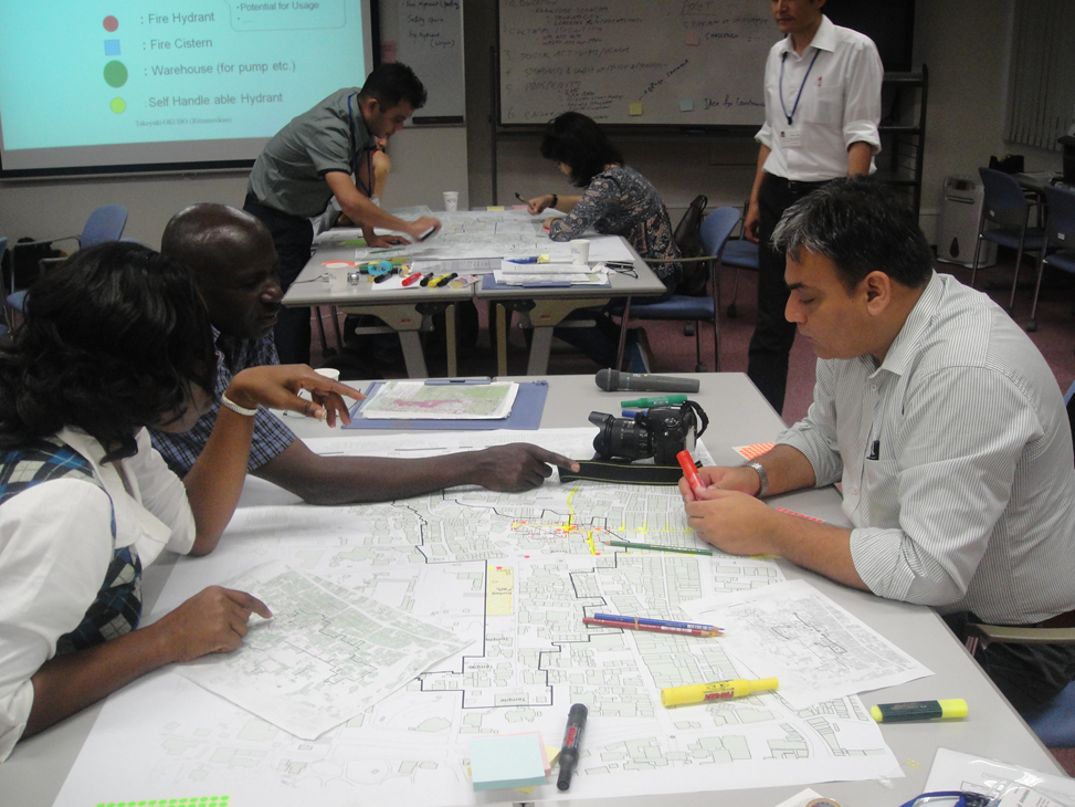
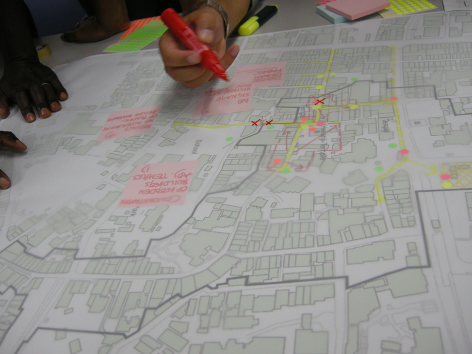
Participants mapping out their analysis on a site map of the district (Legend alongside)
Workshop on Constructing Detailed Disaster Scenarios at Kiyomizu-dera Temple and its Surroundings
Read More...
The objectives of this module are to introduce the basic methodology for undertaking risk assessment of cultural heritage sites and enable participants to prioritise risk reduction strategies and decide on the approach for mitigation. The first stage within this process is the identification and analysis of potential risks.
Identification of risks includes the following aspects:
Risk analysis builds upon risk identification and also takes into account various other issues such as the safety of visitors and local residents.
Risk analysis includes the following aspects:
Risk identification and analysis may be undertaken at:
In the case of World Heritage Sites, this may also be considered at the core zone and buffer zone levels.
Constructing Disaster Scenarios
The next stage of the risk assessment process involves developing possible disaster scenarios for a heritage site. Scenarios are framed on a series of assumptions which are derived from the information gathered in the risk identification and analysis stages. The development of alternative scenarios helps in assessing different possibilities and their potential impacts on heritage resource components. Scenarios should be detailed as a sequence of events with cause-effect relationships. While the exercise itself involves a fair bit of speculation because of the different variables involved, the issues which are highlighted in the process can be addressed effectively in the disaster risk management process. Following the evaluation of disaster risks identified for a cultural heritage site is the prioritisation of risk mitigation strategies. As the concluding section of this module, there is a need to link this section with the next module which addresses prevention and mitigation strategies in detail.
Disaster scenarios would need to consider the following factors or variables:
Thematic Lectures with Secondary Case Studies
Individual steps in risk analysis depend greatly on the scale and nature of the site and the types of hazards being addressed, so at this stage in the course, thematic focus becomes fairly significant. Thematic lecture presentations could potentially be linked with secondary case studies building upon the application of analysis methods to actual heritage buildings or sites.
Primary Case Study
Participants working on a primary case study through the length of the course or though the length of this module could use this opportunity to begin the process of risk assessment on their own with the assistance of the instructor. This could be in the form of independent study groups or discussions or be linked with a workshop combining the content of the various sections of this module.
Participants’ Case Study Project
In case participants are working on individual or team projects of their own selection, they may be given initial assignments based on the material they have gathered prior to the course. Formats and worksheets may be given to participants to initiate this process.
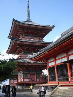
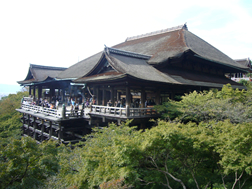
A view of the site
Background
Kiyomizu Temple, officially Otowa-san Kiyomizu-dera, is a temple of the Northern Hosso sect of Buddhism located in Higashiyama, Kyoto. The temple’s origin dates back to 778 AD and it has a long history of disaster followed by reconstruction. The Kiyomizu Temple, a traditional Japanese wooden structure, has no nails or metal devices to assemble its columns and beams. The temple is located within historic preservation district of Sanneizaka
The case of Kiyomizu-dera was used to illustrate all the stages of the risk assessment process by taking into consideration the core area of world heritage and its buffer zone (including Sanneizaka preservation district). This case study was explored through lectures, focusing on treatments and analysis techniques utilised on site as well as an illustration of the methodology of risk assessment. The workshops, which involved participants visiting the site, formed the primary part of this exercise. The workshop aimed to introduce the participants to the analysis of the complexity of a disaster situation in terms of multiple cause-effect relationships. Specifically, it illustrated the basics of dynamics related to the earthquake response of the structure and helped explain the seismic performance of a traditional timber structure, and how it could potentially be strengthened against conceivable risks.
Performance of Historic Masonry Structures, Lecture 6, International Training Course, 2012
Instructor: Aiko Furukawa | Duration: 60 minutes
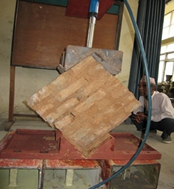
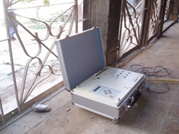
Using secondary case examples of structures in Nepal, the instructor explained the structural behaviour of masonry and how it could be used to predict building behavior in the event of an earthquake. Various experimental systems and theoretical framework were highlighted through this lecture. The following aspects were covered:
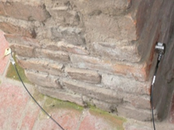
The purpose of the evaluation system was to make guidelines on disaster mitigation of cultural cities in earthquake zones. The investigation of dynamic behaviour by micro-tremor observations was examined, where the micro-tremor sources could range from human activity to natural phenomena. The natural frequencies and damping ratio of the selected building was estimated. The detailed analysis method for masonry may be carried out through FEM (Continuum) or DEM (discontinum) methods. The refined DEM method was then illustrated as an applied technique to a historic masonry building in Nepal.
 |
 |
 |
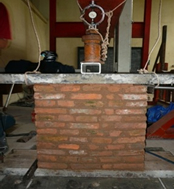
Measurement of a single brick |
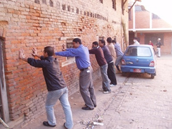
Measurement of a brick wall |
Shear loading test |
 |
 |
 |
Mictotremor observation device |
Free vibration test |
Compression loading test |
Seismic Performance of Japanese Historical Structures, Lecture 6, International Training Course 2011
Instructor: Kazuyuki Izuno | Duration: 60 minutes
This lecture presented an introduction to assessment techniques, investigation into past history of risks and disaster and examination of methods used to assess damage to the structure. It discussed various methods of inspection, the use of simple nondestructive deterioration testing methods in the case of Kiyomizu-dera and subsequent analysis of seismic performance. Kiyomizu-dera also served as the primary case study for the rest of the module, so the lecture directly linked to the site visits and workshops.
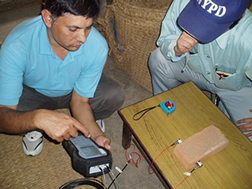
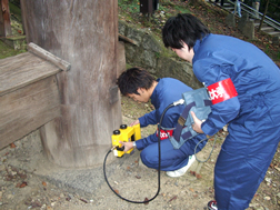
The instructor went into detail into some methods of inspections, such as X-Ray inspection, applying a simple electromagnetic radiation method to find internal damage of the wooden columns etc. The successive stages of risk assessment were also briefly discussed through the example of the Kiyomizu-dera Temple. The session concluded by highlighting the need to carefully assess and mitigate risks at the site.
 |
 |
 |
A view of the site |
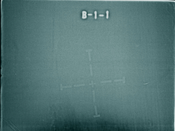
X-ray radiograph of column of Kiyomizu temple containing a void space at the bottom (dark, indistinct region) |
Electromagnetic radiation inspection at Kiyomizu-dera Temple |
 |
 |
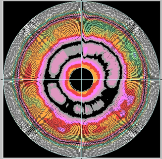
Deteriorated column |
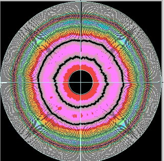
Healthy column |
Electromagnetic radiation inspection mapping. The reflected signal level from the void space was weak (black part) compared to the reflection from a healthy section
 |
 |
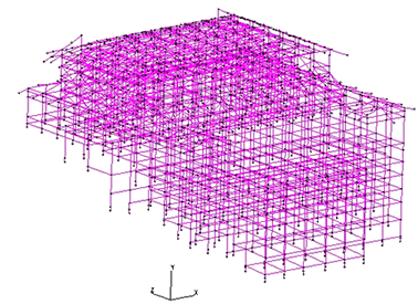
Numerical model of Kiyomizu-dera Temple |
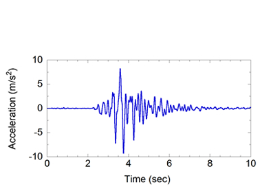
Scenario earthquake accelerations at Kiyomizu-dera Temple |
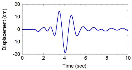 |
Earthquake response of Kiyomizu-dera Temple, which exceeded the damage limit deformation, however, it was within the ultimate collapse limit |
Introducing Community Engagement through the Disaster Imagination Game, Lecture 4, ITC 2011
Instructors: Takeyuki Okubo (and Hidehiko Kanegae) | Duration: 120 minutes
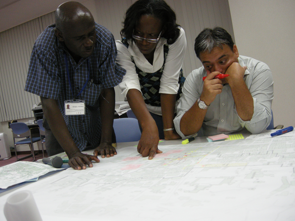
As a result of this session, participants were able to learn about the process of conducting workshops for citizens’ participation and practice these techniques within the context of their own regions and country. They went on to make detailed hazard maps from the viewpoint of local communities and those who live in the sites.
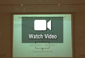
"Disaster Imagination Game (DIG)" is one of the methods that can be used in a workshop, to discuss regional problems and possible solutions regarding disaster mitigation, or to evaluate the ongoing framework. There are three basic steps in this game. Some other gaming techniques and strategies targeted for general participants including school children, were also introduced as part of this session. Role playing games where volunteers take up roles of victims and rescuers were explored through the exercise introduced in the lecture.
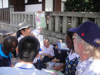
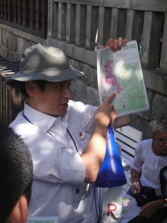
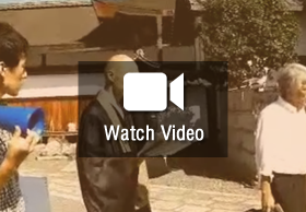
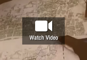
Instructor introducing the site to participants using a detailed map. Secondary information was also circulated through the lecture and other handouts.
Source r-dmuch
GIS for Disaster Management of Historical City, Kyoto. Lecture 11, International Training Course 2011
Instructor: Keiji Yano | Duration: 80 minutes
The objectives of this session were to enable participants to understand the nature of the spatial data available and the techniques of spatial auto-correlation, sampling, and interpolation, as well as how to comprehend GIS-based visualisations that allow users to retrieve recorded information and understand the significance of GIS tools for the purposes of disaster risk management.
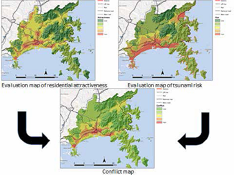
Secondary case examples from Kyoto were used to show how disaster simulation exercises could be conducted virtually to evaluate risks and prioritise mitigation strategies.
This instructor illustrated various scientific methods used to retrieve relevant information from spatially referenced data for the purposes of disaster management. The session was designed to elucidate concepts of GIS with examples, with their focus on the earthquake, tsunami and nuclear crisis, facing Japan since 11 March 2011. The instructor also introduced GIS databases of the historical city of Kyoto, created by Japanese public and private sectors.
The key result of this GIS database of Kyoto in the Virtual Kyoto Project was the possibility of running various simulations related to disasters. As a case study, a simulation to evaluate how accessible cultural heritages would be when an earthquake hits the City was undertaken. In order to predict the accessibility accurately, a simulation model was constructed to estimate detailed attributes of each building by combining multiple data sets, and then simulate if the buildings would collapse at the time of earthquake, and if so, how. The result revealed that, due to building collapse, 8 percent of cultural heritage sites would become totally unreachable, and that another 8 percent would have only 20 percent accessibility. In other words, approximately 20 percent of all the cultural heritage sites are at high risk of being damaged by earthquake-related fire. This result highlighted the urgent need to devise disaster mitigation strategies such as fire extinguishers on site. Through this exercise it can be seen that GIS tools are of immense significance to analysing potential risks to a site based on historical data, geographical attributes and geo-spatial monitoring
References:
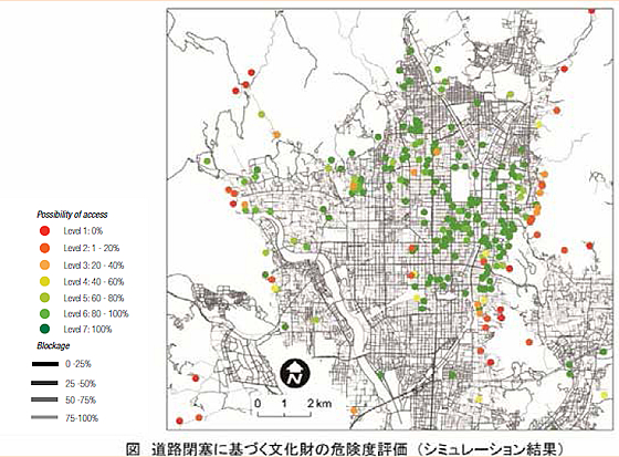
Evaluation of accessibility to cultural heritages in road blockade caused by earthquakes.
(Source: Chihiro KAMEI, Kazumasa Hanaoka and Tomoki Nakaya)
Disaster risk mitigation for the reconstruction plan of Ishinomaki city
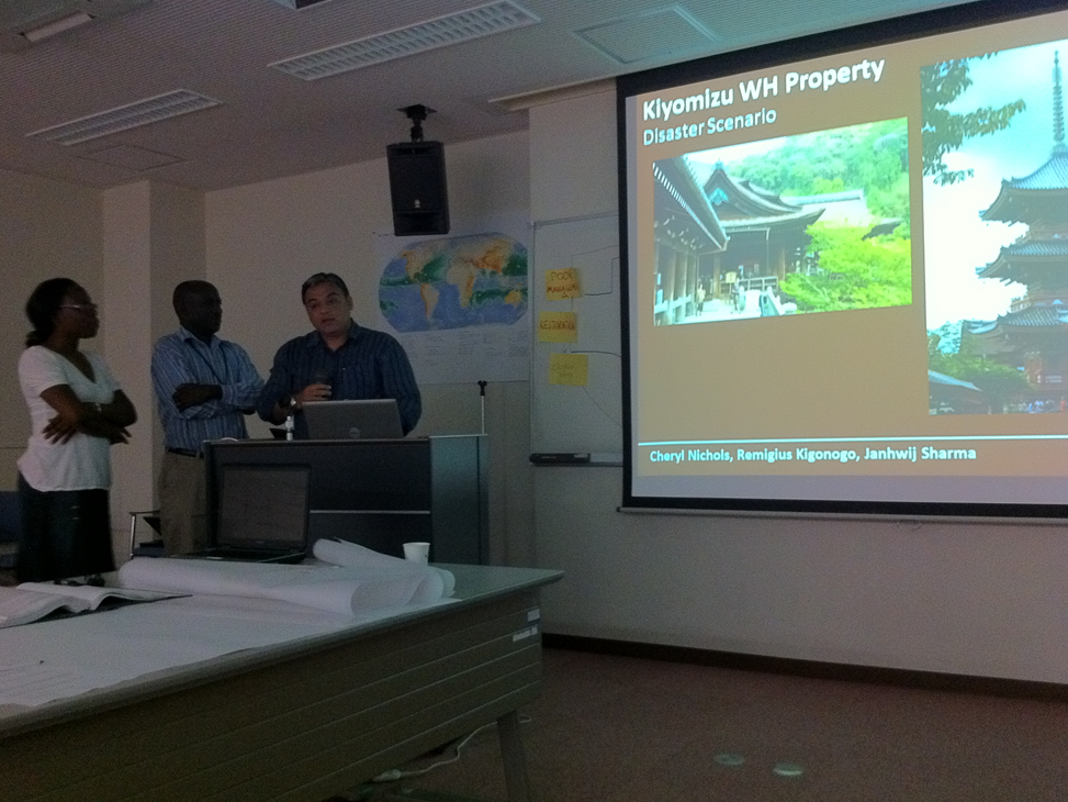
Scenarios prepared by Participants of 2011 r-dmuch ITC (Nichols, Remigius Kigongo, Janhwij Sharma)
Disaster Scenario presented
HAZARD: Earthquake
Magnitude: 7.5 on Richter scale
Duration: 30 seconds and several aftershocks later
Time: 21 July, 2012 (Saturday; 12:25 pm)
Occupancy: 1227 people (within temple)
16,284 residents (within buffer)
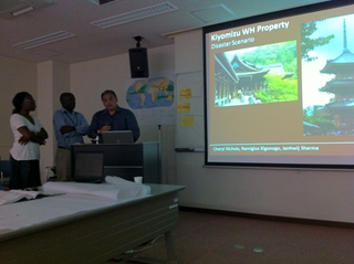
Participants presenting their work.
Source: r-dmuch
Kulangsu, Amoy, China,
Participant: Qing Wei, 2010
Specific Aspect highlighted: GIS Tools for Risk Analysis
Kulangsu, is a unique amalgamation of influences and is representative of several different international cultures owing to its history and development. The narrow streets, together with the architecture of various styles from around the world, give the island a unique appearance.
The participant, Qing Wei undertook a detailed risk assessment of the site, documenting the history of Kulangsu. Kulangsu has an extensive history of typhoons and earthquakes, with over 180 typhoons in the past 50 years. It has also witnessed several fires, with over five in the past three years.
The participant then went on to list the vulnerabilities based on this research. Significantly he illustrated how the risks applicable to the site could be plotted using GIS mapping systems. Thus, the risk of fire to certain areas could be overlapped with identified safe places within the town using GIS mapping technology. This technique could be used extensively to communicate risks to a larger audience.
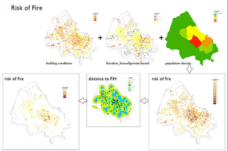
Overlapping maps for identifying risks of fire to the site
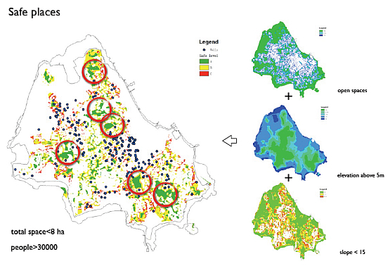
Overlapping maps for identifying safe areas in case of a disaster